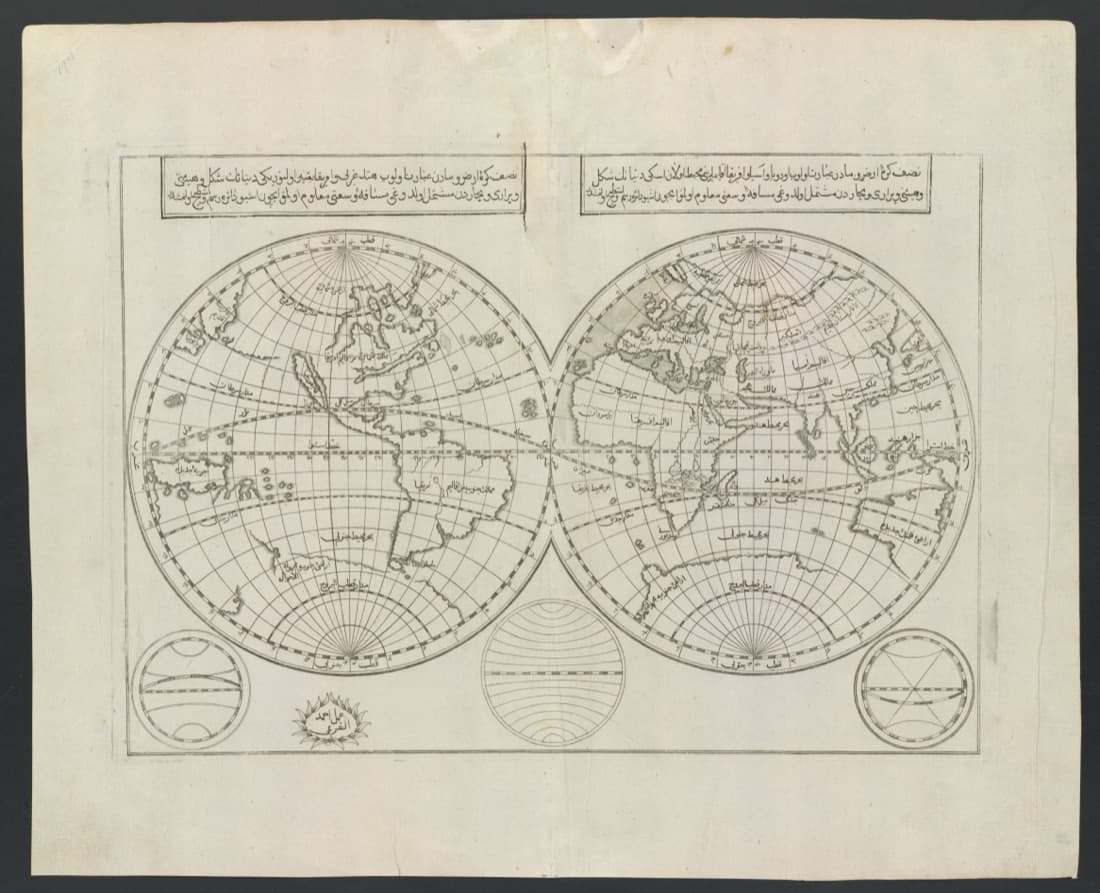
The whole world, printed in Istanbul
Kâtip Çelebi, born Mustafa in Istanbul in 1609, was a clerk in the Ottoman accounting office who went on army campaigns as a young man and spent a small inheritance on books. In 1648 he began a geography of the world, Cihannüma, the mirror of the world. He stopped when he could find no sources on some European countries, and in December 1654 started again, now with the Atlas Minor of Gerard Mercator and Jodocus Hondius, translating from Latin with the help of a French-born convert. He died in 1657 with the second version also unfinished.
İbrahim Müteferrika was born a Unitarian Christian in Kolozsvár, in Transylvania, today Cluj in Romania, sometime between 1670 and 1674. He became a Muslim and rose to a post at the Ottoman court. In July 1727, together with Said Efendi, who had seen printing presses in France, he received a decree from Sultan Ahmed III and a fatwa from the Şeyhülislam allowing them to set up the first Turkish press, for books on anything but religion. Its first book, a dictionary, was finished on 31 January 1729.
Printing itself was not new in Istanbul: a Jewish press had worked there since 1493 and an Armenian one since 1567. A Library of Congress article calls Müteferrika the first Muslim printer of the Ottoman Empire. The often-told story of a sultan's ban on printing in Arabic letters, the TDV Encyclopedia of Islam notes, cannot be documented.
Müteferrika printed Cihannüma on 3 July 1732, in 500 copies, the eleventh book of his press. He completed Kâtip Çelebi's text with the work of a later geographer and notes of his own, and added 40 plates with 52 maps and figures, coloured by hand. The maps are not Kâtip Çelebi's: his own sketches of the world showed only the Old World. This one had already appeared in two of Müteferrika's earlier books, and its outlines closely follow Sanson's world map of 1689, California drawn as an island included. Müteferrika printed seventeen titles before he died in 1745. Cihannüma's modern translators call it the summa of Ottoman geography.
About the work
- Made by
- Kâtip Çelebi (1609–1657); printed by İbrahim Müteferrika (1670s–1745)
- Date
- 1732
- Technique
- Engraved map, a plate in the printed Cihannüma (Istanbul, 1732)
Sources
- [World], Istanbul 1732 Stanford University Libraries
- [World], earlier states of 1729 and 1730 Stanford University Libraries
- Kâtib Çelebi TDV İslâm Ansiklopedisi
- Cihannümâ TDV İslâm Ansiklopedisi
- İbrâhim Müteferrika TDV İslâm Ansiklopedisi
- Matbaa TDV İslâm Ansiklopedisi
- Kemal Beydilli, İstanbul'daki ilk Türk matbaalarında basılan kitaplar Büyük İstanbul Tarihi (İBB, TDV İSAM)
- Gottfried Hagen, Kâtip Çelebi's maps and the visualization of space in Ottoman culture (2012) The Journal of Ottoman Studies, İSAM
- Gottfried Hagen and Robert Dankoff (eds.), An Ottoman Cosmography: translation of Cihānnümā (2021) Sabancı University research repository
- Ibrahim Muteferrika, first Muslim printer of the Ottoman Empire Library of Congress, In Custodia Legis blog
Next story
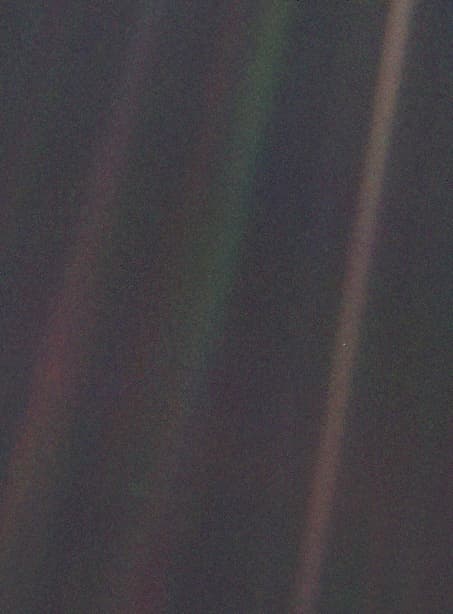 PhotographHome, from six billion kilometres awayOn 14 February 1990 Voyager 1 looked back from about 6 billion km and caught the Earth as a speck smaller than a pixel, at Carl Sagan's urging.1990Read the story