Reading the Moon's history in its face
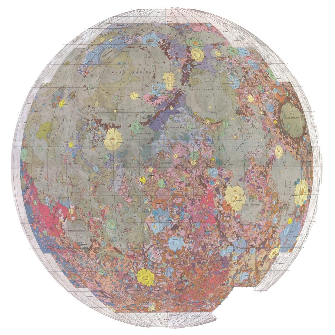
In 1960 the geologist Eugene Shoemaker set up the US Geological Survey's Astrogeologic Studies Unit, and with it a programme to map the Moon's rocks. With NASA's support, a 30-inch telescope on Anderson Mesa near Flagstaff, Arizona, was given over to the work. The method was the one geologists use on Earth: rocks on top are younger than the rocks they lie on.
This map, prepared for NASA and published in 1971, sums up that programme for the whole side of the Moon that faces us. Don Wilhelms and Jack McCauley drew every boundary from Lunar Orbiter IV photographs taken in May 1967, about ten times sharper than the best telescope pictures. Each colour is a rock unit, set in one of the Moon's time systems, from the oldest, the pre-Imbrian, through the Imbrian and Eratosthenian to the youngest, the Copernican.
Those ages were relative: they said what came first, not how many years ago. As the map came out, the first rocks brought back by Apollo were starting to give real dates, the first reliable link between the time scales of the Earth and the Moon.
The mapping programme behind it helped in choosing where Apollo and later missions might land, and Wilhelms himself worked on landing-site selection. In 2020 the Survey published its first complete geologic map of the Moon, built from regional maps of the Apollo era. The painter Don Davis, whose space settlement is also among our Stories, got his start when Wilhelms hired him at the Survey.
About the work
- Made by
- Don E. Wilhelms and John F. McCauley, US Geological Survey
- Date
- 1971
- Technique
- Colour-printed map, scale 1:5,000,000 (USGS map I-703)
- Collection
- US Geological Survey (map I-703)
Sources
- Geologic map of the near side of the Moon (I-703) USGS Publications Warehouse
- I-703 map text US Geological Survey
- Gerald G. Schaber, chronology of USGS astrogeology US Geological Survey (Open-File Report 2005-1190)
- Don Wilhelms USGS Astrogeology Science Center
- USGS releases first-ever comprehensive geologic map of the Moon (2020) US Geological Survey
- Short biography (the artist's own site) Don Davis
Next story
 PosterThe black cat of MontmartreSteinlen's 1896 poster for the Chat Noir cabaret gave Montmartre a black cat that still looks out from souvenir shops along the Seine.1896Read the story